Labels

Showing posts with label hikes. Show all posts

Sunday, June 16, 2013

Hassayampa River Preserve

We have been to the Hassayampa River Preserve in Wickenburg twice in the last two years with friends.  We typically go in the spring, while it's warm but not yet hot.  All of the trees there provide nice shade.

You enter the visitor's center to pay your admission.  The visitor's center has lots of stuff to look at, including some very nice displays about the history of and the wildlife in the preserve.  The staff does provide a fun scavenger hunt for the kids to do while they're on the trails, if you want to partake in that.  After that, you hit the trails.  As you can see, there's a big map of the trail system, complete with photos.


Most of them are flat, easy to navigate with little kids - although it's nice to have big brothers who are willing to carry little sisters when they get tired!


The kids never got tired of looking at bugs, sticks, rocks...all the usual fun things nature has to offer.


There was one steep trail, that leads to a breathtaking view of the preserve and surrounding Wickenburg.


Both of the 4-year-olds with us that day made it up and down, with varying levels of assistance.  It is a little more treacherous of a trail than the others.  I have slipped on gravel both times I've hiked it.  Meanwhile, the kids beat me to the bottom.


The last place we go to is the pond.  It's a favorite.


It was a favorite the year before, too....


We highly recommend the Hassaympa River Preserve as a field trip for families or groups of friends.

Wednesday, June 12, 2013

Granite Dells


On Sunday, we packed up a picnic lunch and lots of water, loaded the kids into the van, and headed up to Granite Dells for lunch and a hike on the Peavine Trail.  We parked at the Preserve.  It was a reasonable $2 fee.  There were covered picnic tables and decent bathrooms right off the parking lot.  After lunch, we set out on the Peavine Trail, which winds along one side of Watson Lake.


A wrap is an invaluable piece of baby equipment when you're a mommy and you're doing lots of walking.


 Soon, we came upon our first glimpse of Watson Lake.  Unfortunately, there is no swimming allowed in the lake.


 Rounding the corner, we were able to see the distinctive Granite Dells.


 It was hot.  We walked about 2 1/2 miles up the trail before we turned back around and headed back to the van.  The trail was flat, easy walking.  Our youngest probably managed about 2 miles on her own before she needed to be carried.


Before we left the Prescott area, we checked out Watson Lake Park.  There was a nice playground there, and more of the Granite Dells that looked like a fabulous place for imaginative play and climbing that would entertain the troops for several hours.


Clint and I are planning to visit again without our kids - in the early fall hopefully.  We'd like it to be just a little cooler.  We'd like to hike the entire Peavine Trail, and perhaps rent a kayak right at the lake and explore the lake that way too.


Thursday, May 30, 2013

Tonto Natural Bridge State Park

Just outside of Payson is what is believed to be the longest natural travertine bridge in the world, at Tonto Natural Bridge State Park.  For someone used to the desert scenery in the Phoenix area (and someone who spent over 25 years living in the Pacific Northwest), the lush greenery of the Payson area was a welcome treat.  I took my daughters, who are currently 11 and 4, to go explore the Tonto Natural Bridge State Park.


There are several hikes that visitors can partake in.  We did two.  We started with the Waterfall Trail, which was mostly a pretty short, but steep, flight of stairs.  My 4-year-old did most of the trek down and back up by herself.


The waterfall at the bottom was...more like a water sprinkle.  Nonetheless, my 11-year-old was delighted.


The next trail we went on was the Anna Mae Trail.  It led to the underside of the bridge.  The trail itself was dirt, which meant it was easy to lose footing and slide on it.  There were areas where I felt like it was necessary to take my 4-year-old's hand.  It would be very easy to take a nasty fall over the edge in lots of places throughout the trail.


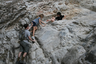
Unlike most trails, where it is smooth sailing once you reach the bottom, the challenge amped up once we reached the bottom of this one.  To reach the under-belly of the bridge, we had to contend with lots of rocks (many of which were slippery) and pools of water (on the way back, my 4-year-old ended up with a wet tennis shoe).  She was a real trouper, but still required assistance from me and her sister to reach the bridge.


Our verdict is that this is definitely worth the trip, in the spring or in the fall.  We brought a picnic lunch and enjoyed it while we were there.

Wednesday, November 23, 2011

Lake Pleasant

Lake Pleasant is the crown jewel of the Maricopa County Parks and Recreation department.  In addition to the lake and all of the activities that water affords, the park also has a Visitor's Center, the Desert Outdoor Center, lots of hiking trails, and holds a variety of classes and special events throughout the year.  Even though we've been in Peoria for almost four years, we've only been up to Lake Pleasant a few times, and we've never been to the Visitor's Center.

My son needed to find ten pieces evidence of wildlife to satisfy a requirement for making Second Class rank in Boy Scouts.  I decided we'd go up to Lake Pleasant, armed with my digital camera, in search of it.  Our first stop was the Visitor's Center.


The inside of the Visitor's Center has a huge wall of mounted fish, a large scale model of the park, items for sale, some wildlife in aquarium style tanks, and other information....


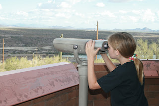
On the back deck of the Visitor's Center, the park has two informational plaques about native plants and native wildlife, a telescope and a place to pan for gold.


The view from the back deck is stunning....

After the Visitor's Center, we drove further back into the park for an easy 1/2 mile hike along the Pipeline Trail, where we were able to find for Jarrod all 10 signs of native wildlife.


Next on my wish list?  A small boat to come up more often and enjoy the lake.

Tuesday, October 25, 2011

White Tanks: Waterfall Trail

It rained last night, so this morning, my family decided to head over to the White Tank Mountains and hike the Waterfall Trail.  We were hoping for the small waterfall at the end of the trail to be active. 

The trail is short and easy.  My 2-year-old walked about half of it on her own this time.

She giggled over being, "left in the dust" by Jarrod and Erica, who are obviously much faster and have more stamina than she does.  When she got tired of walking, there were plenty of sets of arms to carry her.


When we got to the end of the trail, it was bone dry.  Unfortunate for our hopes of seeing a waterfall, but cool because we were able to easily get further back into the crevaces.  Here's what it looks like relatively dry....


The waterfall would normally be immediately to my children's right.  When there's water, it pools in a basin area right behind them, and at the base of the rocks they climbed to get up there.


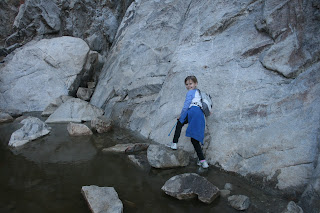
This picture was taken almost three years ago.  The waterfall isn't visible from this picture.  It's behind the big rock my daughter is leaning on to climb.


Again, this area today was completely dry.  Much easier to hike into than when it's filled with water!

You can see the very tiny waterfall here.  I don't know if it ever gets bigger because we've only seen it dry and like this.


And THAT is the pool of water at the base of the rocks my children were climbing, when the waterfall has been bringing water into the area.  As my son can attest after he slipped off the rocks he was climbing on, it is COLD.

We really like this hike because it's an easy one for the whole family.